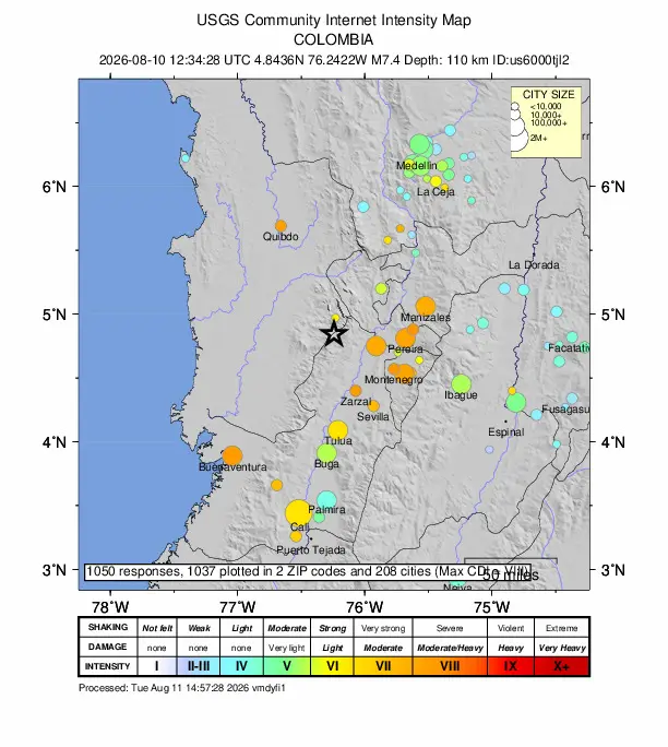
At least 169 people had been reported dead by August 11 after a magnitude 7.4 earthquake struck western Colombia on August 10. An initial 96-kilometer estimate put its focus in the intermediate-depth range, but depth did not prevent buildings from collapsing in several cities.
The 169 deaths were a time-stamped count from the Colombian Association of Capital Cities, which represents the country's departmental capitals. The figure was still preliminary as crews searched damaged buildings and information arrived from communities near the epicenter. The Associated Press reported on August 12 that the toll had risen to at least 265, after the cutoff used for this report.
Reports from damaged cities drove the toll higher
An initial national assessment recorded about 1,600 damaged buildings, including at least 61 that had completely collapsed. Deaths were reported in Risaralda, Valle del Cauca, Chocó, Caldas and Antioquia, while rescuers continued searching buildings in Cali, Pereira, Quibdó and Manizales.
Public missing-person databases grew quickly and produced totals far above the government's count. Some entries could represent people who had lost communications rather than people known to be trapped. APPI News could not verify a single final nationwide missing-person total for the August 11 cutoff.
Chocó posed a further reporting problem. Many communities in the department are reached only by river, and mobile service was disrupted after the quake. That made early damage and casualty assessments less complete outside the largest cities.
The initial 96-kilometer estimate was intermediate depth
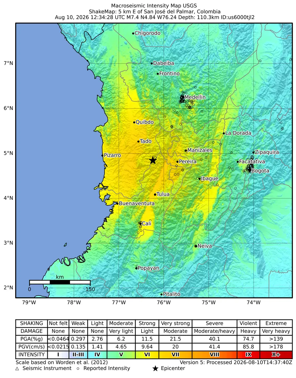
The Colombian Geological Service, the government agency that monitors earthquakes and geologic hazards, initially reported a magnitude of 7.4 and a depth of 96 kilometers near San José del Palmar at 7:34 a.m. Colombia Time (12:34 UTC) on August 10. The source article cited a US Geological Survey reading of 107 kilometers, but APPI News could not retrieve that event-specific value through the agency's text interface.
The US Geological Survey classifies earthquakes from zero to 70 kilometers as shallow, 70 to 300 kilometers as intermediate and 300 to 700 kilometers as deep. Both reported depth estimates would therefore place the Colombian event in the intermediate range.
USGS guidance says shaking weakens as its distance from the earthquake source increases. Under otherwise similar conditions, a focus 96 kilometers down would generally produce weaker shaking directly above it than the same rupture at 20 kilometers. The extra distance does not make a magnitude 7.4 earthquake harmless, and it can leave a broad region feeling the motion.
Depth could not offset urban exposure
The earthquake was felt in Ecuador and Panama as well as across Colombia. A wide felt area does not mean every place experienced the same intensity: distance from the rupture, the frequency and duration of motion, and local soil or rock can change the shaking at a particular site.
USGS says building damage depends on the amplitude, frequency and duration of ground motion, the underlying soil and rock, and whether structures can withstand the vibration. The available reports did not provide a city-by-city structural assessment. They support the conclusion that depth moderated one part of the hazard, not that it should have prevented casualties.
Transport disruption reflected the same uneven pattern. Airports in Quibdó, Manizales and Armenia were among those reported closed during the initial response, while services in several affected cities were intermittent. The reports did not establish one reopening time covering every airport or route.
Colombia declared an emergency as outside aid was offered
Colombian President Abelardo de la Espriella declared a national emergency to accelerate recovery funding. The earthquake struck three days after he took office, leaving the new administration to coordinate rescue operations across several departments.
The US State Department announced US$15.5 million for emergency shelter, food and other response needs, while El Salvador and Mexico said they were ready to assist. Other Latin American governments also offered support. The early pledges did not by themselves establish when personnel or supplies reached each disaster area.
Frequently asked questions
How strong and how deep was the earthquake?
The Colombian Geological Service initially reported magnitude 7.4 at a depth of 96 kilometers near San José del Palmar. The event began at 7:34 a.m. Colombia Time on August 10, 2026.
Does a deeper earthquake always cause less damage?
No. Greater depth increases the distance seismic waves travel to the surface, which generally reduces shaking compared with an otherwise similar shallow event. Magnitude, local ground conditions, building performance and exposure still shape the damage.
Why did the casualty count change so quickly?
Rescue teams were still searching collapsed structures while reports arrived from several cities and remote communities. The 169 deaths cited here are the August 11 source snapshot, and later reports placed the toll higher.
Sources and further reading
- Colombia under a state of emergency after earthquake kills more than 160(El País)
- Magnitude 7.4 quake rocks western Colombia, killing at least 111 people(Associated Press)
- A powerful 7.4 magnitude earthquake struck Colombia(Latin America News Agency via Reuters Connect)
- Determining the Depth of an Earthquake(US Geological Survey)
- At what depth do earthquakes occur? What is the significance of the depth?(US Geological Survey)
- What are the Effects of Earthquakes?(US Geological Survey)
- Earthquake response strains Colombia's new government and rescuers(Associated Press)